By Sue Pascoe
Editor
Residents were invited to listen to a special presentation about a proposed repair for the top portion of the Asilomar hillside (in the El Medio bluffs neighborhood) on Aug. 24.
Arid Motamed of Fugro Consultants told a crowded gathering in the Palisades Library’s meeting room that the first landslide was documented in 1959 and that the geotechnical firm of Ninyo & Moore had done subsequent studies in 2008 and 2013.
Motamed presented colorful slides that displayed retaining-wall options, including a wall with tiebacks; a two-tiered wall with tiebacks; large 10-ft.-diameter concrete poles; a soil-nail wall and deep-soil cement-mixed columns.

Neighbors were queried about which design they would prefer. One person asked, “How are we supposed to know which is best?” Another person wanted to know the cost of each option. (Costs have not yet been determined for each option, but a 2008 geotechnical report prepared by Ninyo and Moore estimated that the cost to remove the landslide and repair the hillside would run about $26 million.)
And then came a question no one expected: “Have you looked at what the Palisades Bowl owner is doing at the bottom of the hill?” The city had not.
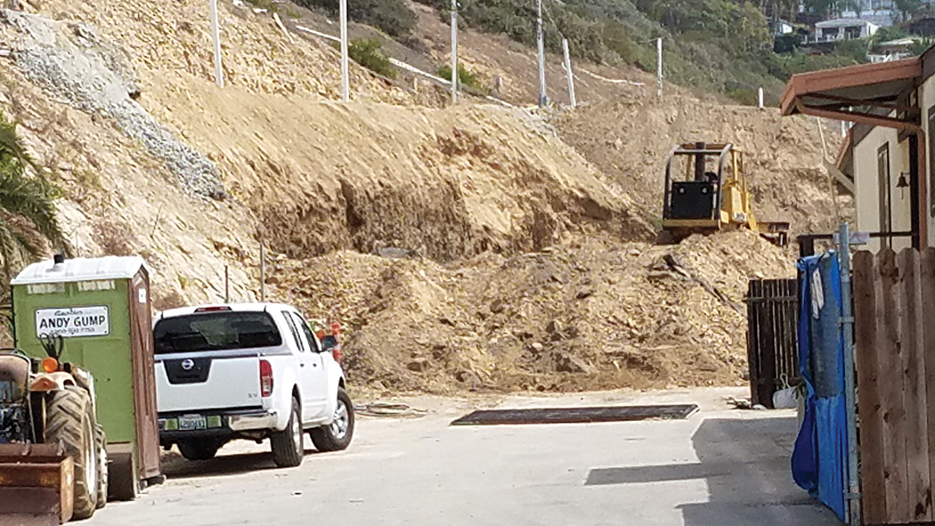
The questioner explained that there was grading at the bottom of the Asilomar hillside, the toe had been cut into and dirt had being hauled out.
The Asilomar hill is actually owned by three different entities. The City owns the upper third, roughly down to Puerto del Mar, which was made impassable in 2005 after heavy rains buckled the roadway.
Edward Biggs, owner of the Palisades Bowl Mobile Park at 16321 Pacific Coast Hwy., owns the bottom part of the hill below the road. The adjacent Tahitian Terrace (also mobile homes) at 16001 PCH is owned by the McDonald family (Azul Pacifico), which also owns the land below Asilomar nearest Temescal Canyon Road.
Although the City of Los Angeles (through Norm Kulla, former senior counsel to Councilman Bill Rosendahl) had reached out to both owners in earlier years, neither were obligated to work with the city, because mobile home parks are under the jurisdiction of the state.
Asilomar Boulevard, between El Medio and Almar Avenues, is built on a hillside that has two landslides. One starts 90 feet below the surface, extends into the Pacific Ocean, and is considered inactive. The other, 35 feet down, is continually moving.
The city installed inclinometers to measure ground movement on Asilomar in 2000. Five years later, the movement of the hill had sheared off the top of one of the inclinometers. A year later a measurement showed that the ground had moved more than a foot vertically.
In May 2015, Biggs received permission from the Coastal Commission to install eight new dewatering wells, a 1,100-ft. keystone wall, and a temporary irrigation system to supplement his existing dewatering system.
Prior to approval, attorney John B. Murdock, who represented residents of Palisades Bowl,wrote in a May 11, 2015 letter to the Commission that additional special conditions should be met before issuing a permit:
“The hillside remediations identified in Permit No 5-08-245 are insufficient to all the development and rehabitation of the lots at the base of the hillside that have been red tagged. The applicant has currently submitted to Coastal Commission and the HCD, documentation regarding a plan to place ‘Resort Homes’ throughout the park.”
The complete list of conditions can be found in the April 2015 permit (documents.coastal.ca.gov/reports/2015/5/f10a -5-2015.pdf).
In approving the plan, the Commission wrote: “The work is designed not to address the larger landslide that covers the approximately 17 acres, but to address the sloughing and minor movement that is occurring along the toe of the slope. Staff is recommending approval of the proposed coastal development permit amendment with four special conditions: 1.) require the applicant to maintain all of special conditions imposed with the original Coastal Development Permit No. 5-08-245; 2.) ensure conformance with the geotechnical report recommen- dations; 3.) ensure the applicant complies with the landscape and irrigation plan; and 4.) indemnifying the Coastal Commission from third-party litigation costs.”
L.A. City Public Information Officer Mary Nemick wrote in a Sept. 6 e-mail to the News, “We have downloaded the plans from the Coastal Commission website and have forwarded the plans to Fugro. At this time we do not know the impact of the construction at the toe of the slope.”
The state was contacted and Housing & Communication Analyst Alicia Murillo wrote in a Sept. 14 e-mail to the News, “The park has the required permits from both HCD and the Coastal Commission for grading. Plans submitted to HCD were stamped by geological engineer and approved by the Department. An HCD field inspector and supervisor were onsite yesterday (9/13/2016) monitoring work being done.”
In a May 2006 article by Alyson Sena (“City and Residents Agree Asilomar Is Safety Concern”), one Asilomar resident wondered why city and state officials had not made Asilomar a priority, comparing the potential danger of the situation to La Conchita, the seaside community between Santa Barbara and Ventura, where a mudslide occurred in January 2005, killing 10 people and injuring many more.


You must be logged in to post a comment.